Worldwide OSM polygons with textual descriptions from the “description” tags
906,631 deduplicated polygon rows, each carrying the source tags, geometry, area, provenance, and exact description text.
Open dataset · GeoParquet 1.1 · ODbL-derived OpenStreetMap data
Which polygons do we keep?
Keep a polygon if it has at least one non empty description tag.
Included
- Tagged closed ways that OSM classifies as areas
type=multipolygonandtype=boundaryrelations that assembledescription=*ordescription:<suffix>=*area=yesremains authoritative
Excluded
- Nodes and open ways
area=no- Empty or whitespace-only descriptions
- Failed relation assemblies and non-polygon output
The snapshot is large in input, selective in output
386 regional PBF extracts become 386 Parquet files totaling 712.4 MiB. The final rows are unique by (osm_type, osm_id); 38,851 duplicate candidates were removed during global deduplication.
Every row keeps the evidence behind the label
Text and provenance
- Base and localized names
- Base and localized descriptions
- Complete original
tagsmap - OSM version, changeset, timestamp, source PBF, and URL
Geometry and measurement
- Full Polygon or MultiPolygon WKB
- OGC:CRS84 longitude/latitude semantics
- WGS84 geodesic
area_m2 - Bounding box covering the complete geometry
Descriptions are predominantly base text, with a multilingual tail
The most common exact localized suffixes are de, en, it, fr, and ru. Suffixes are preserved verbatim; they are not asserted to be valid language codes.
The global distribution is dense but uneven
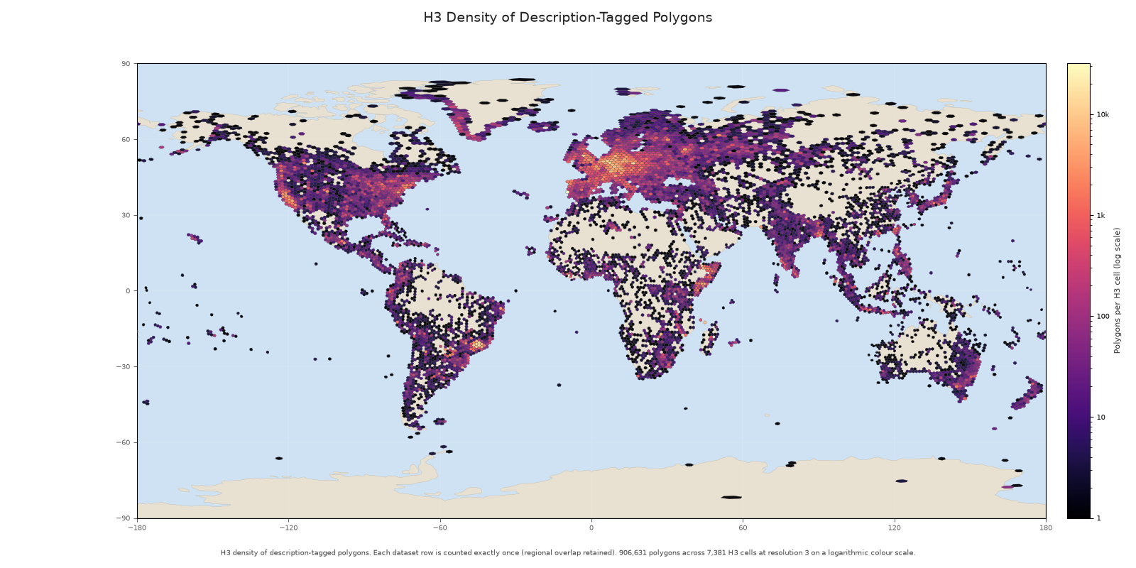
7,381 H3 resolution-3 cells contain rows.
Most polygons are small, but the tail reaches country scale
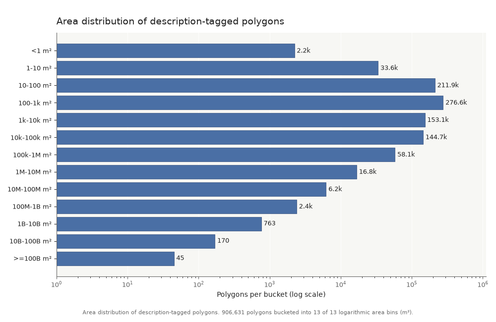
Median area: 501 m² · middle 50%: 85–10,391 m² · range: 0.000062–3.48×10¹² m².
The timestamps span the history of modern OSM mapping
The timestamp is object provenance, not a dataset publication date. Text and geometry reflect the source extracts at their recorded OSM timestamps.
Interpretation needs three guardrails
Language — localized suffixes are exact OSM keys, not validated language codes.
Text quality — descriptions are community-authored and vary in language, formatting, completeness, and quality.
Spatial meaning — the H3 map counts polygon centroids and the extracts are regional snapshots.
Resources
Dataset: huggingface.co/datasets/NoeFlandre/osm-polygon-description-tag
Metrics: Trackio snapshot dashboard
Github: github.com/NoeFlandre/osm-polygon-description-tag
Derived data is © OpenStreetMap contributors and available under ODbL.