Worldwide OSM polygons with linked knowledge
Dataset overview
Wikidata connects real places in OpenStreetMap to multilingual Wikipedia and Wikivoyage text.
Snapshot: 2026-08-02
Every row starts with a real OSM polygon
The pipeline reads Geofabrik extracts and keeps closed ways and multipolygon relations with a non-empty wikidata=* tag.
- 1,184,110 polygon rows across 375 active regions
- each polygon keeps its OSM identity, geometry, tags, centroid, and area
- the raw input set has 386 PBFs; 11 contained extracts are retired from the active set
This is a place-first dataset. Text and facts are linked to the polygon through its Wikidata Q-id.
Seven Parquet tables form one linked dataset
| Table | What it contains |
|---|---|
polygons |
One row per selected OSM polygon |
polygon_articles |
One link row per polygon and Wikipedia or Wikivoyage document |
wikipedia/documents |
Full Wikipedia document rows |
wikipedia/sections |
Section-level Wikipedia text |
wikivoyage/documents |
Full Wikivoyage document rows |
wikivoyage/sections |
Section-level Wikivoyage text |
wikidata/facts |
Selected structured Wikidata claims |
Every table is partitioned by the Geofabrik stem. The link table has a project column so one join works for both text sources.
Wikidata is the bridge between geometry and text
OSM polygon → Wikidata Q-id → Wikipedia documents
OSM polygon → Wikidata Q-id → Wikivoyage documents
Wikidata Q-id → facts table
A document can be linked to several polygons. A polygon can have documents in many languages and in both projects.
document_ididentifies a page revision.projectdistinguishes Wikipedia from Wikivoyage.- Sections reference their parent document, so full text and section text can be used together.
The snapshot has broad coverage, with a clear text boundary
Core scale
1,119,223 unique Wikidata entities
2,273,750 Wikipedia documents
14,420 Wikivoyage documents
Derived text and facts
11,997,165 Wikipedia sections
302,200 Wikivoyage sections
3,901,092 Wikidata facts
666,251 polygons have at least one non-empty Wikipedia or Wikivoyage document, or 56.3% of the polygon set.
Document words count full document rows. Section rows are excluded because they repeat document text.
Text coverage is strongest in Europe, but not uniform
| Continent | Polygons | Wikipedia text | Wikipedia + Voyage | Coverage |
|---|---|---|---|---|
| Africa | 11,289 | 8,309 | 8,309 | 73.6% |
| Antarctica | 254 | 251 | 251 | 98.8% |
| Asia | 117,610 | 94,924 | 94,945 | 80.7% |
| Europe | 792,569 | 373,782 | 373,782 | 47.2% |
| North America | 162,012 | 120,166 | 120,167 | 74.2% |
| Oceania | 19,807 | 11,467 | 11,468 | 57.9% |
| South America | 18,906 | 13,503 | 13,503 | 71.4% |
| Unassigned | 61,663 | 43,824 | 43,826 | 71.1% |
A polygon is assigned by its WGS84 centroid and Natural Earth country boundaries. Offshore or unmatched centroids stay Unassigned. Coverage is text-covered polygons divided by polygons in that row.
Languages show a long tail
Top document languages
| Language | Documents | Share |
|---|---|---|
en |
223,301 | 10.1% |
de |
146,312 | 6.6% |
fr |
109,720 | 5.0% |
ceb |
105,479 | 4.8% |
sv |
74,518 | 3.4% |
ru |
73,228 | 3.3% |
es |
70,808 | 3.2% |
it |
65,927 | 3.0% |
What the distribution means
- 351 languages occur across both projects.
- The top five languages account for 29.9% of all documents.
- The top twenty account for 63.6%.
- Language counts describe document rows.
Two maps answer two different geographic questions
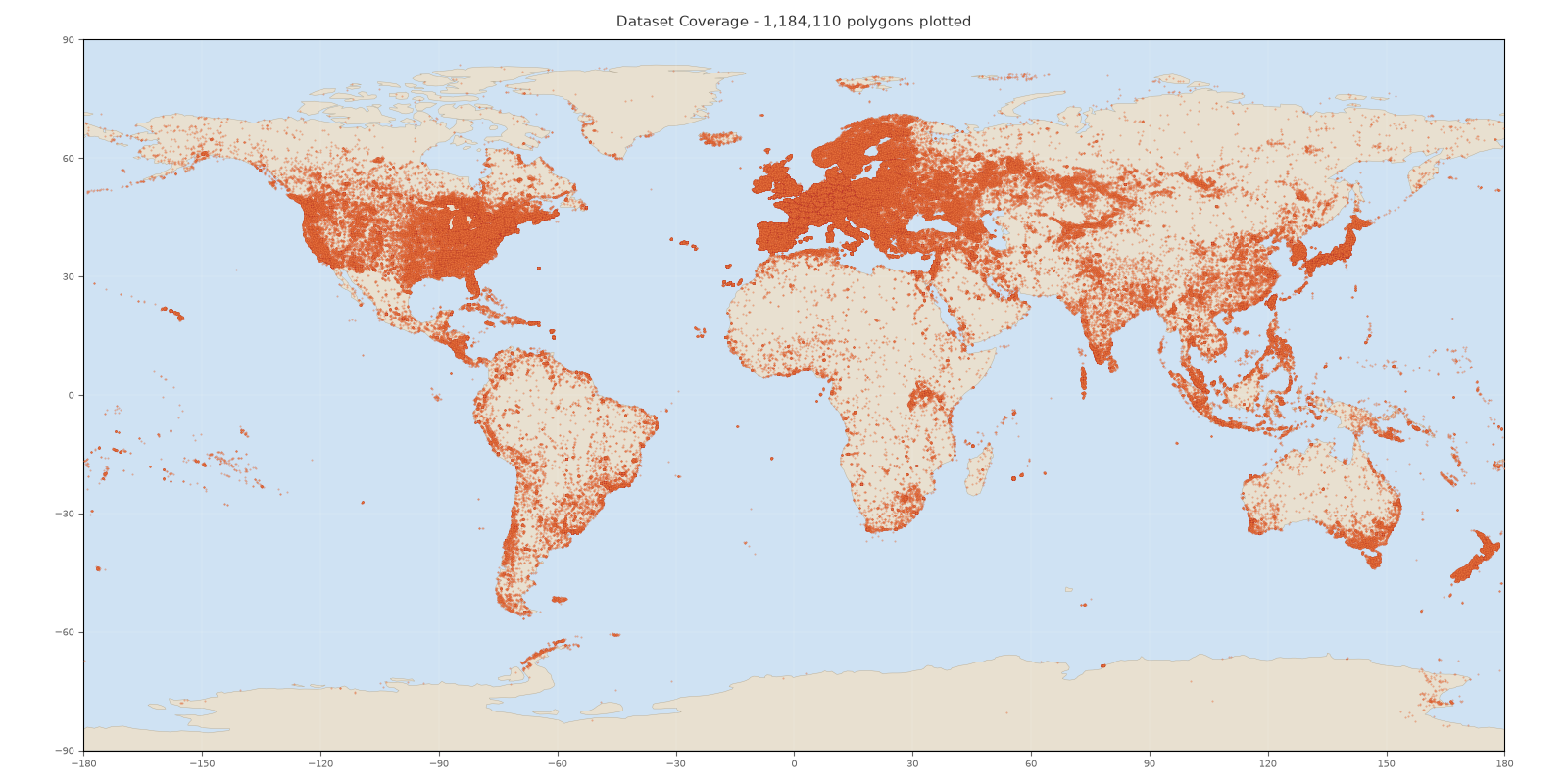
All polygons. Each point is an OSM polygon carrying a Wikidata tag.
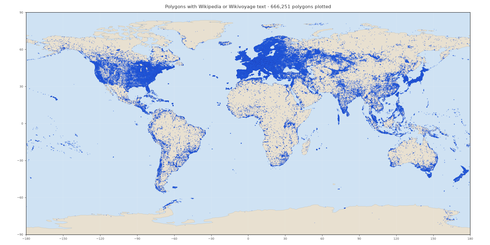
Polygons with text. Each point has non-empty Wikipedia or Wikivoyage text.
H3 density shows where text-covered places cluster
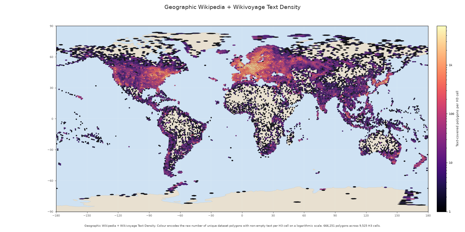
Each H3 cell contains the number of unique polygons with non-empty Wikipedia or Wikivoyage text. A polygon is counted once even if it has several documents.
A reproducible snapshot that is ready to use
- Parquet files are partitioned by region and can be loaded with Hugging Face Datasets or PyArrow.
- Text is plain text with page and revision identifiers, license, and attribution fields.
- Source licenses are explicit: ODbL for OpenStreetMap, CC0 for Wikidata, and CC BY-SA 4.0 for Wikipedia and Wikivoyage.
from datasets import load_dataset
ds = load_dataset(
    "parquet",
    data_files={"polygons": "hf://datasets/NoeFlandre/osm-polygon-wikidata-only/polygons/*.parquet"},
)
The dataset grows through a resumable pipeline
Each run reads new or changed PBFs, enriches only the regions that need work, writes atomic Parquet artifacts, refreshes the generated card and maps, then publishes one coherent Hub update.
Use the codebase deck to see how the pipeline keeps that snapshot deterministic and recoverable.